 The singer/songwriter, Joe South, famously recorded the song, Walk a Mile in My Shoes. The commonly used refrain about “walking a mile in my shoes” refers to being non-judgmental of others. Humorously, it is often extended to “before you criticize someone, walk a mile in his shoes – then when you do criticize that person, you’ll be a mile away and have his shoes”. Some say that research shows the sentiment is rooted in old, Cherokee Indian, native-American wisdom. It remains wonderful advice – “don’t judge a person until you have walked a mile in their shoes”.
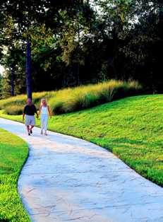
In any event – you can contemplate this personal advice, and other ways to polish up your powers of empathy, by taking a walk on the pathways of our St. Augustine golf course community. The serene and pastoral landscape scenes, all along the pathways, will enable you to exercise your mind – while you do the same for your body.
 A great place to start is within the environs of the Slammer & Squire Neighborhoods and the World Golf Hall of Fame complex. An eight foot wide pathway follows the main roads and minimizes pedestrian / automobile conflicts by coursing below the central bridge on WGV Boulevard (WGVB) at its intersection with Royal Pines Parkway (RPP). The continuous loop from International Golf Parkway (IGP), along WGVB to RPP and then along RPP to IGP – and along IGP back to WGVB – affords an almost complete 2 ½ mile course (approximately 12,400LF). Run or walk this circuit multiple times and, for interest, in opposite directions – and you can have a 5, 7 ½ or 10 mile exercise.
A most unusual and circumferential course is afforded along the Walk of Champions (WOC) at the Hall of Fame (HOF). I recommend starting at the World Piazza – the granite map of the world between the Slammer & Squire golf course waterways and the HOF. The World Piazza is about 350 linear feet from the WOC – connected through the cool and shady breezeway of the HOF. The WOC is about 2,300 linear feet around. The two together create an almost exact ½ mile walk – making combinations for extended walks very easy to calculate (round and round we go).
 The local connecting roads (IGP, Pacetti Road and SR 16) now have completed sidewalks – creating a safe link between the Slammer & Squire Neighborhoods and those of the King & Bear. The walk along IGP from RPP to the intersection of Pacetti Road and SR 16 – and then across to Pacetti Road and to the east entrance of the King & Bear is a short 1 ½ miles. From that same intersection, an out-and-back walk using the twin sidewalks along SR 16 to its intersection with CR 16A is a crisp 3 miles (1 ½ miles out and 1 ½ miles back).
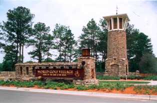
Inside the Neighborhoods of the King & Bear, the 8’ pathway offers a park-like experience with an approximate 2 mile course from the east entrance Tower, along Registry Boulevard, to the Swim & Tennis Center at the Windmill Rotary. Likewise, the sidewalks on Crown Drive and Den Street in the Waterbury Neighborhood make for a 2 ¾ miles walk when measured as an out-and-back from the intersection of Crown Drive and Registry Boulevard. The long out-and-back walk from the Windmill Rotary at the Swim and Tennis Center, along Oakgrove Avenue into the GroveWood Neighborhood and to the end of Boatlanding Drive is about a 4 ½ mile loop. Be sure to look for the original, painted distance markers on the pathway of Registry Boulevard and sidewalks of Oakgrove Avenue – every ¼ mile.
For families with young, school age children it is satisfying to note that Mill Creek Elementary School (on IGP) and Pacetti Bay Middle School (inside the Meadows Neighborhood, just off of Pacetti Road) are both accessible with continuous sidewalk connections.
For your planning purposes (test and measure with your own pedometer / 5,280LF in 1 mile), here are some pathway link approximate distances:
1. WGVB from IGP to the central (curved) bridge = 3,000LF / .57 mile
2. WGVB from IGP to RPP = 3,600LF / .68 mile
3. WGVB from the central bridge to Legacy Trail = 3,650LF / .70 mile
4. Legacy Trail to the World Piazza (via the Slammer & Squire Clubhouse driveway pathway) = 1,750LF / .33 mile
5. World Piazza, through HOF Breezeway, to and around the WOC = 2,650LF / .50 mile
6. RPP between IGP and WGVB = 4,800LF / .90 mile
7. IGP between RPP and WGVB = 3,950LF / .75 mile
8. IGP from RPP to the Neighborhood Park = 3,200LF / .6 mile
9. IGP from RPP to Mill Creek Elementary School = 5,600LF / 1.1 miles
10. IGP between RPP and SR 16 Intersection = 6,600LF / 1.25 miles
11. SR 16 between Pacetti Road and CR 16A = 8,000LF / 1.5 miles (each way, out-and-back, sidewalks both sides of the road)
12. Pacetti Road from SR 16 to Registry Boulevard (at the King & Bear Entrance Tower) = 1,700LF / .32 mile
13. Pacetti Road between Registry Boulevard and The Meadows entrance = 4,700LF / .90 mile
14. Pacetti Bay Middle School from Pacetti Road = 1,200LF / .22 mile
15. K&B – Registry Boulevard from the Entrance Tower to the Windmill = 11,220LF / 2.12 miles
16. K&B – Crown Drive and Den Street linked = 7,260LF / 1.37 miles – one way
17. K&B – Oakgrove Avenue from the Windmill to the Powerline (at entrance to GroveWood) = 10,200LF / 1.93 miles
18. K&B – Entrance to GroveWood to end of Boatlanding Drive = 3,000LF / .57 mile
When you are out and about, on your feet, you will discover a whole new beauty about this place. But, when its time to go home – clicking your heels won’t help – you’ll have to keep going. Hopefully, upon your return to your doorstep, you will be refreshed in body and spirit with a clear conscience and renewed appreciation for your fellow neighbors and your community.


